


Exploring Norway's Fjords 🇳🇴: An Ultimate Road Trip Itinerary from Bergen to the Atlantic Road through Southern and Western Norway, including Rogaland, Vestland, Møre og Romsdal, and more -PART 2

Norway Fjords Road Trip Itinerary PART 2- Introduction:
Norway’s fjord regions — from the dramatic coastal city of Bergen to the wind-sculpted Atlantic Road and the majestic peaks surrounding Geirangerfjord — are a destination that sparks the imagination from the very first sight. Deep blue fjords framed by towering mountains, cascading waterfalls plunging into serene waters, historic towns clinging to rugged coastlines, and some of Europe’s most scenic roads create an unforgettable tapestry of landscapes and experiences.
Whether you’re winding along hairpin turns, hiking iconic trails, sipping coffee in charming villages, or seeking viewpoints high above the fjords, this part of Norway offers a rich blend of nature, culture, and adventure.
In this trip summary post, we will take you through our journey across the fjordlands of Southern and Western Norway — from Bergen and Voss to Lysefjorden, Aurlandsvangen, Sunnfjord, Geiranger, the Atlantic Road, and beyond. We’ll highlight must-see sights, scenic routes, hiking paths, top accommodation, and share our top practical tips for planning your own adventure. You’ll find a Norway fjords road trip itinerary with recommended stops, hiking highlights, the best viewpoints, accommodation suggestions, and the stories behind some of the most iconic places this region has to offer.
Quick note: We’ve divided this guide into 2 parts for easier reading. You are currently viewing Part 2, which covers the regions of Rogaland and Møre og Romsdal in our journey. If you haven't done so already, start with Part 1, which covers the early and central sections of our journey through the Bergen and Vestland region (Western Norway Fjords). This section includes must-see places, information on how to get there, accommodations, and other practical tips for your trip. Click Here For More Details.
Please note that the suggested trip itinerary is based on our preferred visiting locations order and accommodation availability. We encourage you to use it as inspiration and make any changes that suit your time, pace, and interests.
At the end of this part, we’ve also included our custom Google Maps itinerary with all locations linked for easy planning and navigation.
Topics that we will mention in the guide about Bergen to the Atlantic Road through Southern and Western Norway, including Rogaland, Vestland, Møre og Romsdal, and more, Norway:
In Part 1 (Current Post):
In Part 2 (Current Post):
.
*Please note that this post may include affiliate links. This means that if you decide to purchase something through these links, we may receive a commission at no additional cost to you. Rest assured that these are quality products from reliable websites. Your support through these purchases also allows us to invest in and improve the website for your benefit. For more information, please refer to our site's regulations and terms of use.
.
Vestland Region (Western Norway Fjords) [Continued-Twelvth day]:
Places, Hiking paths, Towns, Waterfalls, and Viewpoints you shouldn't miss in Vestland Region:
81. Sunnfjord Museum: [12th day]
Sunnfjord Museum is a tranquil open-air museum located just outside Førde.
It features traditional wooden buildings and exhibits that highlight life in rural Western Norway over the past centuries. Nestled in a green landscape by the water, the museum offers a simple yet meaningful experience, providing a deeper understanding of the culture behind the breathtaking fjord scenery.
82. The Huldra Waterfall (Huldefossen): [12th day]
-If you're arriving by car, we suggest parking at: small parking near Førde Vidaregåande skule avdeling Mo.
Huldefossen is an easily accessible roadside waterfall located near Førde that leaves a strong impression. It plunges 92 meters in a powerful cascade, fed by the waters of Åsvatnet Lake. Even on a calm summer day, the force of the waterfall is genuinely impressive.
A short walk through pastures and woodlands leads you to Huldefossen, where the mist from the waterfall nourishes mosses and ferns. The name is linked to the Huldra, a mythical forest creature in Norwegian folklore.
Located just off the E39, about 10 km from Førde, there’s parking at the agricultural school. It’s a worthwhile stop, but be sure to wear waterproof shoes as the area is quite wet.

83. Gaularfjellet Scenic Route: [12th day-Repeated]
Gaularfjellet Scenic Route (Gaularfjellet Tourist Route) is one of those drives that feels different each time you experience it. The route winds alongside rivers, waterfalls, and peaceful fjord landscapes as it ascends toward the mountains.
During this revisit, we drove once again to Gaularfjellet Viewpoint “The View”, appreciating the same winding road and breathtaking views from a new perspective.
For detailed information and suggested stops along the way, refer back to places 45–50 in our Vestland section.
84. Naturmøteplass: [12th day]
The Naturmøteplass by Holsavatnet lake, located along the Gaularfjellet Scenic Route, is a beautiful and tranquil stop by the lake.
It is a quiet place that offers open views and still water, which reflects the surrounding mountains. Situated at approximately 131 meters (about 430 feet) above sea level, the lake gently stretches through the landscape, providing a calm and picturesque pause during the drive.

85. Viksdalen Church & Stream: [12th day]
Viksdalen Church (Viksdalen kyrkje) is a serene and picturesque stop along the Gaularfjellet Scenic route. Nestled in a lush green valley with a gently flowing stream nearby, it offers a simple yet peaceful setting.
Surrounded by nature, this charming location is perfect for photography, where traditional Norwegian beauty meets stunning landscapes.
86. Viksdalsvatnet Lake Viewpoint: [12th day]
Viksdalsvatnet is one of those quiet, underrated lakes in Viksdalen, where the scenery feels calm and untouched. The still water reflects the surrounding mountains and valley beautifully.
Near the coordinates 61°19'30.7"N 6°04'28.3"E, you'll find a simple yet lovely viewpoint that is perfect for a quick stop and a peaceful photo, away from the more crowded attractions.

-
We returned that day to Bergen- Click here for places you shouldn't miss in the city.
-
Rogaland Region (Southwest Fjord Norway) [4th-6th days]:
The Rogaland region serves as the southern gateway to Norway’s stunning fjord landscapes, showcasing a remarkable contrast between dramatic cliffs, deep fjords, and open coastal scenery.
Notable locations such as Lysefjord, which features iconic viewpoints like Preikestolen and Kjerag, exhibit some of the most breathtaking landscapes in the country.
Unlike the more mountainous fjord regions further north, Rogaland combines rugged natural beauty with charming coastal towns and expansive beaches, creating a diverse and dynamic travel experience.
This is a region where fjords meet the North Sea, and each turn offers a new perspective on Norway’s wild and varied beauty.
How many days should you spend in the Rogaland Region (Southwest Fjord Norway)? We spent approximately 2.5 days in this region; however, you can easily spend at least 4-5 days here.
Recommended Accommodations in Rogaland Region (Southwest Fjord Norway):
1. Hjelmelandsvågen Town: [4th day]
Hjelmelandsvågen proved to be an excellent one-night stop during our road trip through the Rogaland Region (Southwest Fjord Norway). It was quiet, scenic, and perfectly located for continuing our journey deeper into the region the next morning. Surrounded by fjords, mountains, and ferry connections, this small town has a relaxed atmosphere that makes it ideal for unwinding after a long day of driving. We spent our fourth night here before waking up early for more exciting adventures.
During our stay, we chose to stay at Hjelmeland Hostel & Camping (Hotel Nøkling & Camping), a simple accommodation located near the waterfront with views of the fjord and mountains. Although our experience wasn't entirely satisfactory for personal reasons, we still found Hjelmelandsvågen to be a practical and peaceful overnight stop on our fjord itinerary.
-
2. Verkshotellet Jørpeland Hotel: [5th Day]
For a stay in Jørpeland and as a base for exploring Preikestolen (Pulpit Rock), we recommend Verkshotellet Jørpeland. This cozy and historic 3-star hotel is located right in the town center, making it an excellent starting point for discovering the Lysefjord region and nearby Preikestolen.
The family-run hotel features bright, Nordic-style rooms equipped with private bathrooms, smart TVs, free Wi-Fi, and complimentary on-site parking, which is especially convenient for those on a fjord road trip. The hiking trail to Preikestolen is only about 9 km (5.6 miles) away. Additionally, Stavanger can be reached in approximately an hour by car and ferry.
At the hotel, you can enjoy breakfast and dinner, as well as relax while taking in views of Jørpelandsvågen harbor, all within walking distance of local cafés and shops.
Places, Hiking paths, Towns, Waterfalls, and Viewpoints you shouldn't miss in Rogaland Region (Southwest Fjord Norway):
1. Flesefossen Waterfall (Flesefossen, Brattlandsdalen): [4th day]
Flesefossen Waterfall, located in the picturesque Brattlandsdalen valley in the Rogaland region, is a stunning roadside attraction.
Situated along the scenic route connecting Sauda and Røldal (Rv520), this waterfall cascades down steep green slopes, offering a peaceful and refreshing break during your drive.
It is easily visible from the road and serves as a delightful spontaneous highlight that invites visitors to pause, take a photo, and appreciate the tranquil beauty of the surrounding valley.
This is a perfect example of how even lesser-known sites in Norway can feel remarkably special.

2. Old Farmhouse Viewpoint (Gammel Gård ved Rv13, Suldalsosen – Suldalsvatnet Lake View): [4th day]
-If you're arriving by car, we suggest parking at: 59°36'07.0"N 6°45'44.3"E [Free Parking].
The Old Farmhouse Viewpoint (Gammel Gård ved Rv13) is a hidden gem located along the scenic Route Rv13 near Suldalsosen, offering stunning views of Suldalsvatnet Lake.
From a small parking area, a short uphill walk leads you to an old farmhouses situated above the road.
Once there, you are rewarded with peaceful, expansive views of the lake and the surrounding mountains.
This simple stop is well worth the brief climb, providing a quiet and authentic glimpse into rural Norway, all framed by a fantastic panoramic backdrop.

3. World's largest traditional Jærstol (Verdas største jærstol): [4th day]
The World's Largest Jærstol Chair (Verdas største jærstol) in Hjelmelandsvågen is a delightful and unexpected roadside attraction that adds a playful element to your journey through the Rogaland region. Inspired by the traditional design of the Jærstol wooden chair, this oversized sculpture celebrates local craftsmanship and heritage in a unique way.
Situated along the scenic route, it serves as a convenient stop—perfect for stretching your legs, taking a creative photo, and enjoying a lighthearted moment amidst the dramatic natural landscapes.
-
We spent the night in Hjelmelandsvågen Town and woke early the next day for another exciting adventure. We stayed at Hotel Nøkling & Camping, but we were not satisfied with the accommodation for a couple of personal reasons.
-
4. Høllesli/ Lysefjorden viewpoint (Høllesli rasteplass): [5th Day]
Høllesli / Lysefjorden Viewpoint (Høllesli Rasteplass) is one of the most impressive roadside stops that overlook the famous Lysefjord in the Rogaland region.
Located along the scenic route to Lysefjorden, this viewpoint offers a stunning panorama of the fjord, surrounded by steep cliffs and pristine nature.
Easily accessible with a designated rest area, it is the perfect place to pause, take photos, and appreciate the grandeur of one of Norway’s most iconic fjord landscapes.

5. Lysefjord Bridge (Lysefjordbrua): [5th Day]
The Lysefjord Bridge (Lysefjordbrua) is a stunning suspension bridge that spans the entrance of Lysefjorden in Rogaland. Opened in 1997, it is the only road connection across the fjord, stretching about 639 meters (0.4 miles) high above the water.
While stopping on the bridge is not allowed, nearby viewpoints offer beautiful views of the fjord landscape, making it a memorable entry into one of Norway’s most dramatic regions.

6. Ferry in Lysefjorden and the Lysefjorden: [5th Day]
The Lysefjord Ferry offers an excellent way to truly experience the Lysefjord from the water, providing a unique perspective. Stretching about 42 km, Lysefjorden is renowned for its dramatic cliffs and iconic landmarks, such as Preikestolen and Kjerag, which rise majestically above the deep blue water.
We took the ferry early in the morning from Forsand (Forsand ferjekai) to Lysebotn and then returned to Songesand kai. This journey turned out to be a highlight of our trip—calm waters, fewer crowds, and breathtaking views along the way.
It’s essential to book tickets well in advance, especially if you’re traveling with a car, as this route is very popular during peak season (we booked 5 months in advance). Click here for ferry tickets purchasing.
The ride from Forsand to Lysebotn takes about three hours, while the trip from Lysebotn to Songesand kai takes approximately one hour.
Relaxing on the deck while passing by waterfalls, steep cliffs, and remote farms makes this journey not just a mode of transportation but a memorable experience in itself.
7. Lysebotn Village (Lysebotn): [5th Day]
Lysebotn Village is a remote and dramatic settlement located at the very end of the Lysefjorden, surrounded by towering cliffs, waterfalls, and steep mountain walls.
It can be accessed by ferry or by traveling along the famous Lysevegen road, which features 27 hairpin bends.
The journey to reach Lysebotn is just as memorable as the destination itself. Despite its small size, the village feels truly unique — a quiet place where nature dominates the landscape.
Whether you arrive by boat or by road, Lysebotn is a special stop that showcases the power and untouched beauty of this part of Norway.
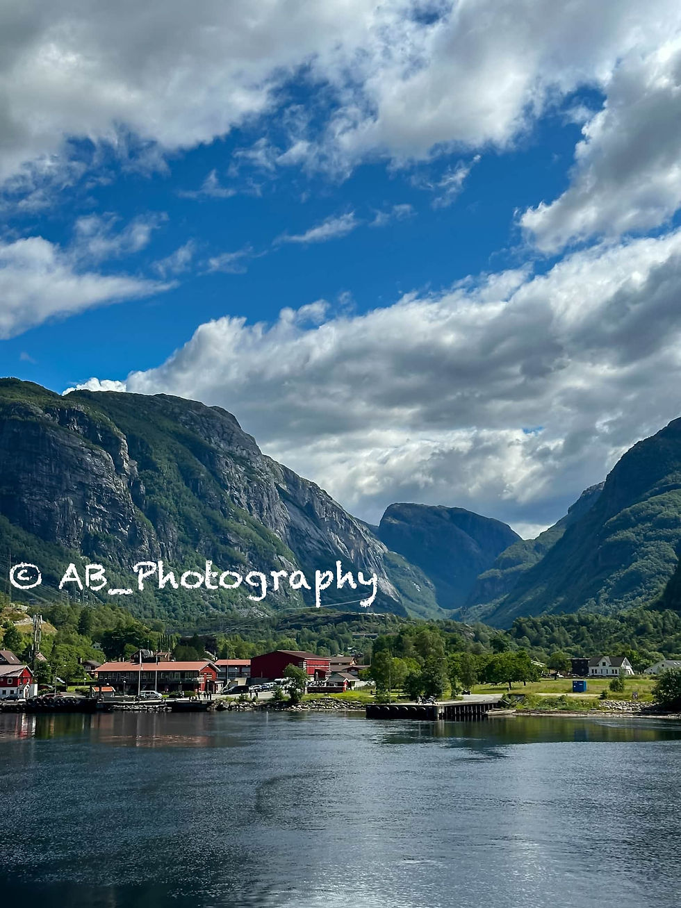
7.1. Lysebotn Guest Harbor (Lysebotn gjestehamn):
Lysebotn Guest Harbor (Lysebotn gjestehamn) is a serene and scenic marina located at the very end of the Lysefjorden, surrounded by towering cliffs and dramatic mountain landscapes.
Situated right by the ferry dock and along the route of the famous Lysevegen road, it serves as a natural stopping point for boats, ferries, and travelers.
Whether you arrive by ferry or car, the harbor offers a calm and picturesque atmosphere, making it perfect for a short walk to soak in the surroundings.
It is also an excellent spot for photography, especially with the reflections of the mountains and boats on the still waters of the fjord.
7.2. Lysebotn Fjord Café (Lysebotn Fjord Kafé):
Lysebotn Fjord Café (Lysebotn Fjord Kafé) is a cozy and welcoming stop located near the water’s edge and ferry dock in Lysebotn, perfectly situated at the end of the fjord.
The café offers simple meals, coffee, and snacks while providing beautiful views of the harbor and surrounding cliffs.
Whether you arrive by ferry or drive along the scenic Lysevegen road, it’s an ideal place to pause, relax, and enjoy the tranquil fjord atmosphere—a simple yet memorable stop in this remote corner of Norway.

8. Lysebotn/Lysevegen route (Lysevegen): [5th Day]
Lysevegen Road, also known as The Lysebotn Road, is one of Norway’s most thrilling and memorable drives. It connects Lysebotn with the mountain plateau above the fjord.
Renowned for its 27 dramatic hairpin bends and steep ascent, this road winds its way up from the fjord through tunnels and rugged mountain terrain, offering breathtaking views at every turn.
A unique feature is the Øygardstøl tunnel, which spirals inside the mountain before emerging high above the fjord.
The road stretches approximately 29 kilometers (18 miles) and rises around 900 meters (2,950 feet) from sea level to the mountains above. Built in the 1980s to connect the remote Lysebotn area with the surrounding region, it quickly became a bucket-list drive due to its striking design.
Often considered one of the most scenic and adventurous routes in the Rogaland region, it may not be officially listed as one of Norway's Scenic Routes, but it surely offers an unforgettable experience by combining engineering marvels, adrenaline, and stunning views.
9. Lysebotn Waterfall Stop & Natural Pool (Lysebotn Stiga – “Parking and Swimming” Spot):[5th Day]
Lysebotn Waterfall Stop & Natural Pool (Lysebotn Stiga – “Parking and Swimming” Spot) is a hidden gem along the famous Lysevegen road, situated in the midst of the dramatic ascent above Lysefjorden.
This small roadside stop features a natural waterfall that cascades into a clear mountain pool, providing a refreshing and peaceful break during your drive.
With a small parking area nearby, it’s an ideal spot to pause, cool off on a warm day, and savor a quiet moment in nature—one of those spontaneous stops that make this scenic route so memorable.

10. Kjerag Cafe & Restaurant (Øygardstøl-Kjerag Café og Restaurant): [5th Day]
-If you're arriving by car, we suggest parking at: KJERAG Parking [Free Parking for Kjerag Cafe & Restaurant Visitors]
Perched high above the dramatic curves of the famous Lysevegen scenic road, Kjerag Cafe & Restaurant (Øygardstøl) feels more like a front-row seat to one of Norway’s most iconic fjord landscapes than just a simple stop.
Located around 600 meters above Lysefjorden, this cozy "Eagle’s Nest" serves as the natural basecamp for the legendary Kjerag hike—whether you're fueling up before your climb or treating yourself afterward.
Expect hearty Norwegian comfort food, such as salmon soup, burgers, and warm drinks, all complemented by panoramic views over Lysebotn and the winding road below.
It’s one of those places where you end up lingering longer than you planned—coffee in hand, with clouds drifting through the valley, you come to the quiet realization that this is exactly what fjord travel is all about.
11. Kjerag / Kjerag Mountain (Kjeragfjellet): [5th Day]
-If you're arriving by car, we suggest parking at: KJERAG Parking [The parking lot requires payment at the onsite machines, either by credit card or cash].
Kjerag (Kjeragfjellet) rises dramatically above Lysefjorden and is one of Norway’s most iconic fjord experiences—raw, exposed, and undeniably unforgettable.
The trail begins at Øygardstøl, situated along the legendary Lysevegen scenic road, known for its famous hairpin bends.
This trail takes you deep into a rugged alpine landscape before unveiling breathtaking views over the fjord and the world-renowned Kjeragbolten boulder, which is suspended nearly 1,000 meters above the water.
The hike is a significant commitment, stretching approximately 10–11 kilometers (6–7 miles) round trip, and takes about 5–8 hours to complete. It has a moderate-to-difficult rating (approximately 7.5/10) due to steep climbs, exposed sections, and chains bolted into the rock.
Realistically, this is a full-day experience, especially when combined with nearby highlights along this part of Lysefjorden. Unfortunately, we had to skip this hike due to time constraints, despite it being high on our list of priorities.
To ensure seamless trail navigation, even without internet access, we highly suggest using AllTrails for your hiking plans. Download the trail map and consider upgrading to the premium plan before your adventure, so you can stay on course without the stress of losing signal. Click here to explore the trail map and crucial details, guaranteeing you're confidently guided every step of your journey.
12. Songesand Ferry Stop (Songesand ferjekai): [5th Day]
Songesand Ferry Stop (Songesand ferjekai) is a serene and somewhat hidden spot along the waters of Lysefjorden, best reached by ferry. Surrounded by steep fjord walls, it offers an atmosphere of stillness and raw nature, far removed from the hustle and bustle.
We arrived from Lysebotn Village via a picturesque ferry ride that lasted 40 to 60 minutes, passing beautiful waterfalls and towering cliffs along the way.
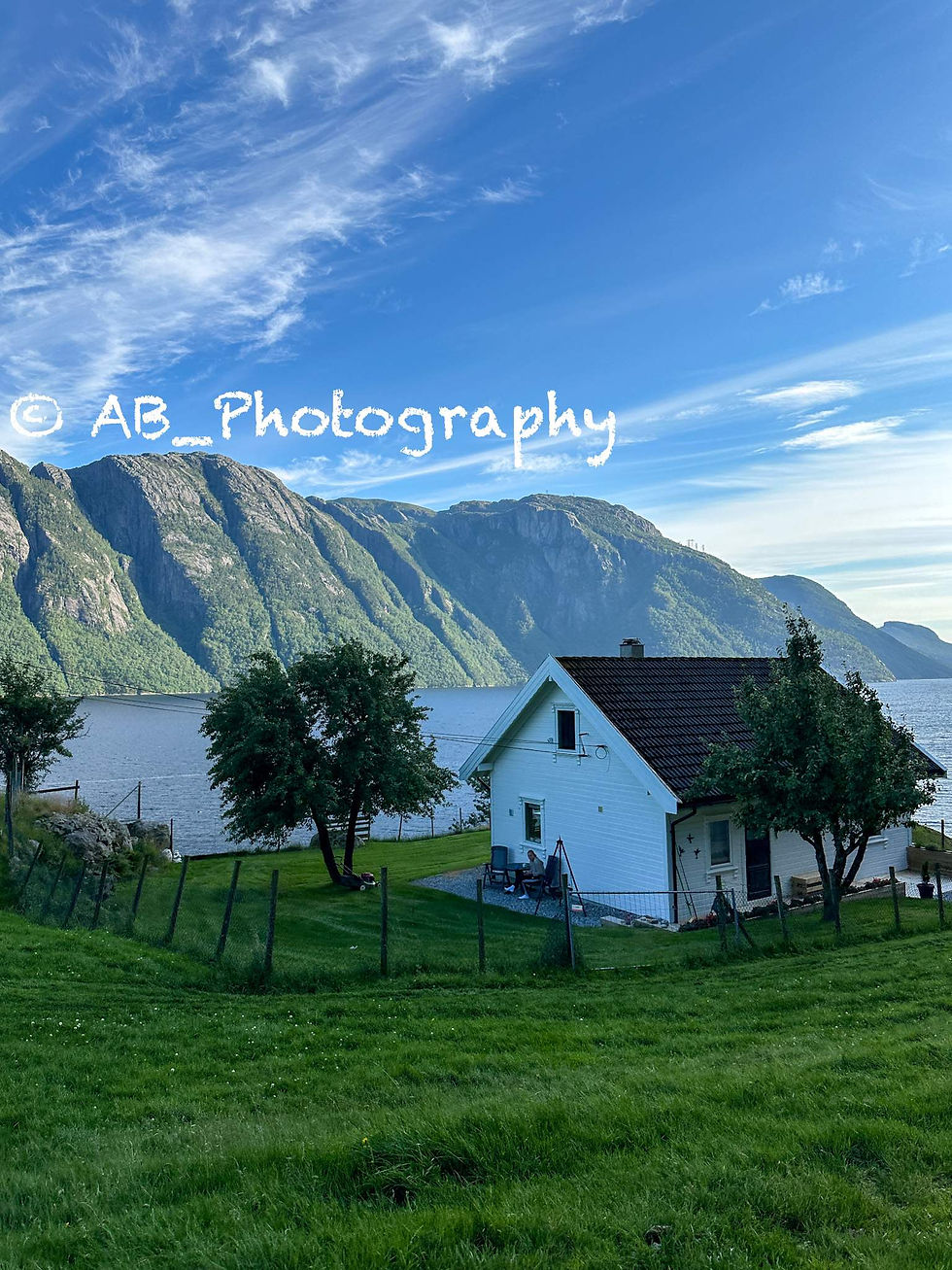
13. Sandvatnet Lake on Fv661: [5th Day]
Just a short drive from Songesand along the quiet Fv661 road, Sandvatnet Lake is an unexpected stop that instantly slows everything down.
With its calm waters stretching between rugged mountains, it feels more like a hidden alpine beach than a roadside stop—perfect for a brief pause after the ferry.
The road winds through untouched fjord landscapes, making the journey as memorable as the destination.
It’s simple and peaceful—exactly the kind of place you discover in Norway and wish you could stay a little longer.

14. Jørpeland Town: [5th Day]
After a full day of fjord adventures, Jørpeland felt like the perfect place to slow down.
Known as the gateway to the iconic Preikestolen and situated along the Norwegian Scenic Route Ryfylke, this small coastal town offers a calm, lived-in charm with stunning views of the fjord and surrounding mountains.
We decided to end our day here and stayed overnight. Honestly, it was exactly what we needed: quiet streets, fresh air, and that peaceful Scandinavian vibe that makes you want to linger just a little longer before the next adventure.
-
We spent the night in Verkshotellet Jørpeland Hotel and woke early the next day for another exciting adventure.
-
15. Pulpit Rock (Preikestolen): [6th Day]
-If you're arriving by car, we suggest parking at: Preikestolen Parking - P1 [The parking lot requires payment at the onsite machines, either by credit card or cash].
Rising dramatically 604 meters (approximately 1,982 feet) above the deep blue waters of Lysefjorden, Preikestolen, also known as Pulpit Rock, is a destination that truly lives up to its reputation. This iconic viewpoint features a nearly flat cliff that seems to be suspended in the sky, offering a breathtaking experience.
The hike begins near Jørpeland along the Norwegian Scenic Route Ryfylke. It takes you through a mix of forest trails, rocky terrain, and sweeping vistas before reaching the renowned flat cliff edge. The trail is approximately 8 kilometers (5 miles) round trip and typically takes around 4-5 hours to complete. It has a moderate difficulty level of about 6.5 out of 10—challenging enough to feel rewarding, yet accessible for most hikers.
Timing is crucial for this hike. It is highly recommended to start as early as possible to avoid heavy crowds and to maximize your day, as it can easily take over your itinerary.
We consider this one of the best hikes in the fjords, with an effort-to-reward ratio that is dramatic, unforgettable, and absolutely worth it if you plan your visit wisely.
To ensure seamless trail navigation, even without internet access, we highly suggest using AllTrails for your hiking plans. Download the trail map and consider upgrading to the premium plan before your adventure, so you can stay on course without the stress of losing signal. Click here to explore the trail map and crucial details, guaranteeing you're confidently guided every step of your journey.
16. Hikers' Café (Turistkafé Preikestolen): [6th Day]
Located right at the trailhead of Preikestolen, Hikers’ Café Preikestolen BaseCamp is the perfect spot to relax after a long hike—simple, cozy, and ideally situated.
It offers warm meals, snacks, and hot drinks just steps away from the main trail, making it a great place for hikers to refuel and unwind while enjoying the beautiful natural surroundings.
Whether you’re grabbing a quick coffee or settling in for a proper meal, it’s the perfect place to slow down, recharge, and fully appreciate the Preikestolen experience before continuing your journey.

17. Preikestolen BaseCamp (Preikestolen Fjellstue): [6th Day]
Preikestolen BaseCamp (Preikestolen Fjellstue) is conveniently located at the trailhead of Preikestolen, making it more than just a starting point for your hike—it is an integral part of the overall experience.
Nestled in a forest and overlooking the serene waters of Revsvatnet, the highlight of this location is the collection of minimalist green cabins that blend harmoniously into the landscape, creating the ideal "Scandinavian nature escape" atmosphere.
Whether you arrive before your hike or want to relax afterwards, this is a perfect spot to unwind—sit by the lake, breathe in the tranquility, and let the fjord adventure settle in.

18. Marvik/ Sandsfjorden Viewpoint (Marvik Utsiktspunkt-Sandsfjorden): [6th Day]
Located just before the Sandsfjordbrua bridge near Marvik, this small roadside viewpoint is a hidden gem that captures the serene beauty of Rogaland.
Overlooking the calm waters of Sandsfjorden—a 25 km fjord that stretches through the region—it provides a peaceful spot with expansive views of the surrounding mountains and quaint fjord villages.
While not part of a scenic route, this drive offers hidden viewpoints that turn an ordinary road into a memorable fjord journey.

19. Østasteidn Rest Area & Viewpoint (Ostasteidn rasteplass): [6th Day]
Located just after the Sandsfjord Bridge, Østasteidn Rest Area & Viewpoint (Østasteidn Rasteplass) is a beautifully designed stop that transforms a simple drive into an experience.
Situated along the Norwegian Scenic Route Ryfylke, this architectural viewpoint blends harmoniously with the landscape.
A short walkway leads to tranquil seating areas that overlook the calm waters of Sandsfjorden.
Inspired by the moody paintings of artist Lars Hertervig, the entire space exudes a subtle, artistic atmosphere—minimalist, peaceful, and perfectly suited for a leisurely pause with a stunning view.

20. Vikaneset Viewpoint (Vikaneset utsiktspunkt): [6th Day]
Vikaneset Viewpoint (Vikaneset utsiktspunkt) is a worthwhile stop along the Fv520 road to Sauda. Offering stunning views above the fjord and steep mountains, it invites you to pause and appreciate the scenery.
This viewpoint is part of the Norwegian Scenic Route Ryfylke, known for its dramatic fjord and mountain landscapes, making the drive as memorable as the stops. Even a quick visit captures the essence of Norway's wild beauty.

21. Svandalsfossen Waterfall (Svandalsfossen-Sauda): [6th Day]
Just before reaching Sauda, Svandalsfossen Waterfall is a breathtaking roadside attraction that immediately captures your attention.
Located along the Norwegian Scenic Route Ryfylke (Rv520), the waterfall cascades approximately 180 meters (about 590 feet). What makes it even more remarkable is the striking metal staircase that allows you to climb 540 steps beside the rushing water, offering various viewpoints.
It’s a quick stop if you choose, but you can also take your time to feel the mist and experience the raw, untamed beauty of Norway up close.
22. Sauda Lighthouse (Sauda fyr- Saudafjorden): [6th Day]
Tucked along the edge of Saudafjorden, Sauda Lighthouse (Sauda fyr) embodies the serene side of fjord travel. With stunning views of the fjord and surrounding mountains, this spot offers a tranquil atmosphere—still waters, soft light, and a sense of escape from the everyday rush.
Located near Sauda in the picturesque Ryfylke region, it’s a perfect place to pause and appreciate the quiet beauty of Southwest Norway.

23. The zinc mines Allman gorge (Sinkgruvene Allmannajuvet NSR): [6th Day]
Carved deep into a dramatic gorge along the Norwegian Scenic Route Ryfylke (Fv520), the Allmannajuvet Zinc Mines (Sinkgruvene Allmannajuvet) is a remarkable location where raw nature meets history.
Once an active mining site from 1881 to 1899, the area has since been transformed into a striking architectural landmark. Minimalist structures now perch above the rugged canyon, showcasing the region’s industrial past.
During our visit, we stopped primarily to take in the view, and honestly, that alone was well worth it. Standing above the wild river winding through the gorge, it became one of those brief moments that unexpectedly leaves a lasting impression, even without stepping into the museum.
-
24. Knut Vesthassel Memorial Viewpoint (Vista aérea Bauta Knut Vesthassel), Midtvatnet Lake & Botnavatnet Lake: [6th Day]
Along the Norwegian Scenic Route Ryfylke (Fv520) towards Horda, the area around the Knut Vesthassel Memorial Viewpoint (Vista aérea Bauta Knut Vesthassel) and the twin lakes Midtvatnet and Botnavatnet offers a continuous panoramic view.
Located high on a mountain plateau, the landscape features expansive, reflective lakes surrounded by rugged terrain, farmhouses, waterfalls and an endless sky—it's a place where you will find yourself stopping multiple times to take in the beauty.
This is not just a single marked viewpoint, but rather a series of stunning photography spots, where every angle resembles a postcard, and the road itself enhances the experience.
25. Ryfylke-Fv520 Mountain View Rest Area (Rasteplass Mountain View): [6th Day]
Nestled along the Norwegian Scenic Route Ryfylke (Fv520) toward Horda, these mountain rest area serve as natural viewpoint amidst wide plateaus and shimmering lakes.
The scenery feels raw and otherworldly, making it a perfect spot for photography.
It's a place where you might stop for just a minute but end up staying longer, as every direction reveals a unique frame of Norway's wild highlands.

26. Svartavatnet Lake Viewpoint (Svartavatnet utsiktspunkt) & Mountain Dam Reservoir (Staudamm): [6th Day]
Situated along the Norwegian Scenic Route Ryfylke (Fv520) toward Horda, Svartavatnet Viewpoint offers a stunning, serene landscape. The dark waters of the lake reflect the surrounding mountains and shifting sky, creating a cinematic scene.
The mountain dam reservoir stands as an unexpected landmark amid a wild, untouched landscape. Surrounded by open plateaus and still waters, it combines raw nature with subtle human engineering, creating a scene that feels both powerful and peaceful. Though not a formal viewpoint, it’s an underrated photography spot where the reflections and silence invite you to linger.
It’s a quick stop that invites you to pause and appreciate the wild, remote beauty of this part of Norway.
-
On this trip day, we returned to the Vestland Region (Western Norway Fjords) (click here to continue our daily itinerary at Part 1 of this guide).
Møre og Romsdal Region (Western Norway Fjords) [8th-11th days]:
Møre og Romsdal is where Norway’s fjord landscapes become even more dramatic, featuring larger mountains, deeper fjords, and striking contrasts at every turn.
This region stretches along the northwest coast, showcasing alpine peaks that rise directly from the ocean, countless waterfalls, a rugged coastline, and iconic roads like Trollstigen and the Atlantic Road. It offers an unforgettable experience.
Less polished and often less crowded than the southern fjords, Møre og Romsdal embodies a unique charm: its raw, powerful scenery feels more untamed, making it a perfect next chapter in any journey through Norway's fjords.
How many days should you spend in the Møre og Romsdal Region (Western Norway Fjords)? We spent a total of about 4 days exploring the Møre og Romsdal Region (Western Norway Fjords) during our visit. However, since it is a vast area, you can easily spend more time there, depending on your preferences.
Recommended Accommodations in Møre og Romsdal Region (Western Norway Fjords):
1. Grande Fjord Hotel: [8th Day]
For our stay in Geiranger, we chose the 4-star Grande Fjord Hotel, which is beautifully positioned above the renowned Geirangerfjord, a UNESCO World Heritage Site. Although we stayed for only one night, this hotel is an excellent base for exploring the region over several days, thanks to its peaceful location and panoramic fjord views.
This stunning 4-star hotel is ideally located right by the UNESCO-listed Geirangerfjord, surrounded by dramatic mountains and breathtaking scenery. Most rooms feature private balconies that overlook the fjord, while the panoramic restaurant on the 6th floor serves Scandinavian cuisine and a generous breakfast with an incredible backdrop.
We particularly enjoyed the beautiful lounge and bar area, along with the free jacuzzi that offers stunning views of the fjord — the perfect place to relax after a day of exploring nearby attractions. The tranquil setting just outside Geiranger village makes it an excellent base for discovering the fjords for several days.
2. Frich's Express Hotel (Frichs Ekspress Åndalsnes): [9th Day]
During our exploration of Åndalsnes and its surrounding highlights, we spent a night at the 3-star Frich's Express Hotel. This modern and practical hotel is set against some of Norway’s most dramatic mountain scenery. Conveniently located above the Alti Rauma shopping mall, the hotel features easy self-check-in, free parking, and a relaxed atmosphere right in the heart of town.
The rooms are modern, comfortable, and well-equipped, with some offering views of the mountains and river. After a day of exploring nearby attractions like Trollstigen, Rampestreken, and Romsdalseggen, the cozy lounge area provides a perfect spot to unwind. We found the location particularly convenient, as it offers easy access to shops, cafés, and various services all within the same building.
3. Sunde Fjord Hotel: [10th Day]
For our overnight stop near Eidsnes and Solavågen, we stayed at Sunde Fjord Hotel. This simple and comfortable hotel is ideally located just steps from the Solavågen ferry terminal. Surrounded by stunning mountains and fjords, the hotel may not be luxurious or fancy, but it is clean, quiet, and provides everything you need for a relaxing overnight stay during a road trip through the fjords.
At the accommodation, you can enjoy free parking, complimentary Wi-Fi, and a satisfying breakfast before continuing your journey. Many of the rooms offer beautiful views of the sea and surrounding mountains.
We also appreciated the cozy lounge area with complimentary tea and coffee, which made for a pleasant stop along the scenic E39 route near Ålesund.
Click here to explore more details and secure your room!
Places, Hiking paths, Towns, Waterfalls, and Viewpoints you shouldn't miss in Møre og Romsdal Region (Western Norway Fjords):
1. Geiranger–Trollstigen Scenic Route: [8th Day]
The Geiranger–Trollstigen Scenic Route (Geirangervegen–Trollstigen turistveg) is one of the most iconic drives in Norway. This winding road, carved into steep mountains, offers stunning views of fjords, waterfalls, and valleys at every curve.
The route stretches approximately 104 km (about 65 miles), ascending from fjord level to an elevation of 1,038 meters above sea level. It combines the dramatic scenery of the west coast with a rich tradition of travel and exploration.
Key highlights along the way include the 11 hairpin bends of Trollstigen, the breathtaking overlook from Ørnesvingen with views of Geirangerfjord, lush valleys dotted with strawberry farms in Valldal, and numerous viewpoints that invite you to stop and take in the scenery.
The journey also includes a ferry crossing (Eidsdal–Linge) and offers constantly changing landscapes, making it more than just a drive.
It’s truly a full-day to two-day experience where the journey becomes the destination. We spent nearly two days exploring this route, and on a later trip day, we drove it in the opposite direction.
2. Breiddalen Valley Lookout (Breiddalen utsiktspunkt): [8th Day]
The Breiddalen Valley Lookout (Breiddalen utsiktspunkt) offers a distinctly different experience along the Geiranger–Trollstigen Scenic Route compared to the dramatic fjord cliffs.
Here, you can enjoy wide, open vistas of nearly endless mountain scenery stretching in every direction. Surrounded by high plateaus and rugged peaks, this quiet stop allows one to truly appreciate the vastness of Norway.
Although it may not be a major landmark, it is the type of peaceful, photogenic viewpoint that makes this iconic route so memorable.

3. Mountain & Valley Viewpoint (Utsiktspunkt over fjell og daler): [8th Day]
Along the Geiranger–Trollstigen Scenic Route, the "Mountain & Valley" Viewpoint (Utsiktspunkt over fjell og daler) is a simple yet breathtaking stop where the landscape opens up dramatically.
Here, you can see layered valleys, steep peaks, and endless mountain scenery. The viewpoint also offers views of Djupvatnet, a high-mountain lake.
While it isn't a marked highlight, it's the perfect spot to pull over unexpectedly—to take in the vastness, snap a photo, and enjoy a quiet moment amidst Norway's wild terrain.

4. Djupvatnet Viewpoints & Lake (Djupvatnet utsiktspunkt & Djupvatnet): [8th Day]
Continuing along the Geiranger–Trollstigen Scenic Route, Djupvatnet Viewpoint (Djupvatnet utsiktspunkt) is a breathtaking high-mountain stop that feels almost surreal.
This glacier-fed lake sits at an elevation of approximately 1,016 meters (about 3,333 feet) and is often still edged with snow, even in the summer.
The deep blue water, rugged peaks, and alpine atmosphere create an incredibly photogenic scene.
Just around the lake, the Djupvasshytta offers another accessible viewpoint right at the shoreline, providing a slightly different perspective.
It’s a simple yet striking high-altitude stop, making it one of the highlights of the entire drive.
5. Scenic View Stop: [8th Day]
Just after Djupvatnet and before reaching Geiranger, there is an unmarked viewpoint along the Geiranger–Trollstigen Scenic Route. This spontaneous stop is one of those unforgettable experiences.
There are no signs or official names, which adds to its charm: it’s a quiet pull-over with a breathtaking view, creating one of those moments where the drive surprises you the most.

6. Scenic Viewing Terrace (Taras widokowy): [8th Day]
Just before descending into Geiranger along the Geiranger–Trollstigen Scenic Route, you’ll find a small viewing terrace (utsiktsterrasse) that is a must-stop for photography and enjoying one of the best views of Norway.
From this vantage point, you can enjoy a sweeping view of Geiranger village, the fjord, and the surrounding mountains, all coming together in one stunning scene.
It’s a quick stop, but it’s one of those moments where you can pause, take it all in, and appreciate one of Norway’s most iconic landscapes.
Please note that there is a very limited parking space at this spot.
7. Flydalsjuvet Viewpoint & Queen Sonja’s Chair (Flydalsjuvet utsiktspunkt & Dronning Sonjas stol (skulptur)): [8th Day]
The Flydalsjuvet Viewpoint (Flydalsjuvet utsiktspunkt) is one of the most iconic viewpoints in Norway, and for good reason. Located just before the descent into Geiranger along the Geiranger–Trollstigen Scenic Route, this viewpoint offers breathtaking panoramic views of Geiranger village, the fjord, and the surrounding peaks.
It features both upper and lower platforms, each providing different angles to take in the stunning landscape.
On the lower level, you will find Queen Sonja’s Chair (Dronning Sonjas stol), a sculptural seat that offers a perfect spot for photos. This chair, inaugurated in 2003, has become a signature photo opportunity.
It is an incredible place to capture the classic view of the Geiranger fjord, making it one of the best photography stops in the area.
Please note that there is a very limited parking space at this spot.

8. Geiranger Waterfall Walk (Fossevandring): [8th Day]
-If you're arriving by car, we suggest parking at: Parking in front of Hotel Union Geiranger.
Located right in the center of Geiranger, the Geiranger Waterfall Walk (Fossevandring) offers a short yet impactful experience.
The trail is approximately 0.9 kilometers (about 0.6 miles) long and consists of over 320 steps that ascend alongside the powerful Storfossen waterfall.
As you make your way up or down the trail, you’ll get closer to the rushing water, while stunning views of the village and fjord gradually unfold.
It's a straightforward hike that provides some exercise and a fantastic opportunity to experience the raw power of nature in Geiranger up close.
9. Blair's Viewpoint (Blair’s utsiktspunkt): [8th Day]
Blair’s Viewpoint (Blair’s Utsiktspunkt) is a quiet, lesser-known stop that offers a truly stunning view of the Geirangerfjord and the surrounding mountains.
Located along Fv63 near Geiranger, it provides a more peaceful alternative to the busier viewpoints, making it perfect for a quick stop and a great photo of this UNESCO-listed fjord.
Simple, scenic, and surprisingly calm, it feels like a hidden gem.
-
10. Geiranger Village (Geirangerfjord): [8th Day]
Nestled at the very end of the Geirangerfjord, Geiranger is one of Norway's most iconic fjord villages. This small, picturesque location is completely surrounded by towering mountains and stunning waterfalls.
With a population of just a few hundred residents, Geiranger is situated within a UNESCO World Heritage landscape known for its dramatic cliffs and cascading waterfalls.
The scenic Fv63, also known as the Geiranger–Trollstigen Route, passes through the area, making Geiranger not just a destination, but the heart of an unforgettable fjord experience in Norway.
-
We spent the night in Grande Fjord Hotel and woke early the next day for another exciting adventure.
-
11. Geiranger–Trollstigen Scenic Route: [9th Day]
Early in the morning, we continued our journey on this magnificent road.
-
12. Small Viewpoint & Eagle Bend (Piccolo utsiktspunkt & Ørnesvingen): [9th Day]
Along the Geiranger–Trollstigen Scenic Route, even the smallest pull-offs deliver unforgettable views—and this little “piccolo” viewpoint paired with Ørnesvingen (Eagle Bend) is one of the best.
Found about 600–620 meters (approximately 1,970–2,035 feet) above the fjord, it provides a dramatic overlook of the Geirangerfjord, showcasing stunning waterfalls like the Seven Sisters and nearly vertical mountainsides.
Ørnesvingen is one of the most famous viewpoints on the route, and is the name of the 11 hairpin bend of the road that climbs steeply and lushly from Geiranger toward Eidsdal.
This viewpoint is easy to reach, making it an amazing photography spot that rivals larger landscapes. It is both an engineering marvel and a highlight of the drive.
Please note that there is a very limited parking space at this spot.
13. "Natural Shower" at Eagle Bend ("Naturlig dusj" ved Ørnesvingen): [9th Day]
Just near Ørnesvingen (Eagle Bend) along the Geiranger–Trollstigen Scenic Route, you’ll encounter a delightful surprise: a small waterfall that cascades across the road, creating a natural shower effect.
This brief, refreshing stop allows you to get close to the rushing water—or even drive through the spray—adding a playful and memorable moment to one of Norway’s most picturesque drives.

14. Korsmyra Rest Area (Korsmyra rasteplass): [9th Day]
Korsmyra Rest Area (Korsmyra rasteplass) is a surprisingly great stop along the Geiranger–Trollstigen Scenic Route (Rv63). It features a large parking area, clean restrooms, and stunning views of the surrounding mountains and fjord.
This rest area is often one of the first major stops when traveling from or to the Geirangerfjord if you're driving toward or from Eidsdal. It's the perfect place to take a break, stretch your legs, and appreciate the scenery before continuing your journey.
It's simple, practical, and scenic—all in one convenient stop.

15. Eidsvatnet Lake Viewpoint (Eidsvatnet Utsiktspunkt): [9th Day]
Near Eidsdal, the Eidsvatnet Lake Viewpoint (Eidsvatnet utsiktspunkt) offers a peaceful, refreshing contrast to the dramatic fjord views nearby. With its calm waters, gentle reflections, and a more relaxed atmosphere, it serves as an ideal stop along the Geiranger–Trollstigen Scenic Route.
Easily accessible from the road, there are several pull-offs available, making it a perfect location for a short break or a picnic after exploring the busier Geiranger area. Simple, serene, and beautifully photogenic, this viewpoint is one of those understated spots that adds balance to your journey.
16. Valdall Waterfront (Valldal strandpromenade): [9th Day]
Located along the shores of the Norddalsfjorden, Valldal Waterfront (Valldal Strandpromenade) is a tranquil stop where the fjord meets everyday village life.
This small waterfront area in Sylte is part of a quiet fjord village, surrounded by steep mountains and fertile valleys, offering a relaxed place to pause, walk, and enjoy the scenery.
Simple, peaceful, and slightly underrated, it provides a nice change of pace from the more dramatic viewpoints nearby.
17. Gudbrandsjuvet Gorge & Café (Gudbrandsjuvet & Gudbrandsjuvet kafé): [9th Day]
-If you're arriving by car, we suggest parking at: 62°19'50.8"N 7°28'18.7"E [Free Parking].
Gudbrandsjuvet and Gudbrandsjuvet Café are must-visit stops that beautifully combine raw natural beauty with thoughtful design.
This narrow gorge features a river crashing through a deep canyon, enhanced by modern walkways and viewpoints right above the water. Situated on the renowned route between Valldal and Trollstigen (along the Geiranger–Trollstigen Scenic Route), it's an impactful quick stop.
Here, you can walk across bridges, feel the power of the rushing river, and then relax at the café, which is known for its unique architecture and excellent coffee with a view over the gorge.
Short, dramatic, and memorable, this hidden gem is definitely a place you shouldn't miss during your visit.
18. Valldøla River & Small Waterfall Viewpoint (Valldøla utsiktspunkt): [9th Day]
Just a short walk from the parking area near Gudbrandsjuvet, this small viewpoint overlooking the Valldøla River offers a peaceful escape from the busy gorge. You’ll find a rushing river, small cascades, and crystal-clear water flowing through the rocks.
The viewpoint is accessible within a few minutes from the parking area, making it a quick yet scenic stop that perfectly complements the dramatic gorge nearby.
Simple, raw, and photogenic, it’s one of those hidden gems that provide an unexpected bonus during your drive.

19. Øvstestøl Bridge & Traditional Norwegian Village (Øvstestølbrua & Øvstestøl): [9th Day]
-If you're arriving by car, we suggest parking at: 62°23'03.5"N 7°34'36.9"E [Free Parking]
Near Valldal, the Øvstestøl Bridge and Traditional Norwegian Village (Øvstestølbrua & Øvstestøl) is a charming stop that feels like stepping into a classic Norwegian postcard.
You'll find traditional wooden houses, green fields, and a river gently flowing through the valley.
Located along the route to Trollstigen, on the Geiranger–Trollstigen Scenic Route, this quiet and authentic village scene beautifully contrasts with the nearby dramatic fjords.
The highlight of the area is “Bobby’sbrua- Bobby’s Bridge,” a small bridge that serves as an excellent photography spot, perfectly framing the river, houses, and mountains in a simple yet unforgettable shot.
20. Valldøla River Viewpoint (Valldøla utsiktspunkt): [9th Day]
Located near Trollstigen along the Geiranger–Trollstigen Scenic Route, the Valldøla River Viewpoint (Valldøla utsiktspunkt) is a quick stop that allows you to truly experience the raw power of nature.
From this viewpoint, you can gaze down at the glacier-fed river as it carves its way through a narrow valley, often displaying a milky turquoise color due to the glacial sediment.
This spot is simple, wild, and surprisingly impressive for such a brief visit—it's definitely worth pulling over to see, even if just for a moment- it’s one of those blink-and-you-miss-it viewpoints worth pulling over for.

21. Starting Point of Mannen Hiking Trail & Viewpoints (Mannen tursti): [9th Day]
Just before Trollstigen, the starting point of the Mannen Hiking Trail (Mannen tursti) is a low-key stop that offers more than you might expect. It features a beautiful river flowing through the valley, stunning views of the surrounding mountains, and a serene atmosphere at the trailhead.
Even if you don’t embark on the full hike, it’s a great spot to stretch your legs, enjoy the scenery, and experience a quieter side of this iconic area along the Geiranger–Trollstigen Scenic Route before arriving at the famous Trollstigen.
22. Trollstigen Viewpoint (Trollstigen Utsiktpunkt): [9th Day]
-If you're arriving by car, we suggest parking at: Trollstigen car park.
Perched high above one of Norway’s most dramatic mountain landscapes, the Trollstigen Utsiktspunkt offers a stunning view of nature at its most cinematic. Sleek viewing platforms extend out over the valley, standing about 850 meters above sea level. Here you can enjoy sweeping panoramas of jagged peaks, cascading waterfalls, and the iconic serpentine road below.
Located at the upper starting point of Trollstigen and along the famed Geiranger–Trollstigen National Tourist Route, known for its dizzying hairpin bends, this viewpoint beautifully combines raw wilderness with striking modern architecture.
It's a place where you will naturally find yourself lingering longer than you initially planned.
23. Trollstigen Outer Viewpoint (Trollstigen Ytre Utsiktspunkt): [9th Day]
The Trollstigen Outer Viewpoint (Trollstigen Ytre Utsiktspunkt) provides a unique perspective that is quieter, slightly more exposed, and equally unforgettable.
Situated on a dramatic mountain plateau at around 850 meters above sea level, this outer viewpoint allows you to take in the vastness of the landscape from a more open, almost suspended angle.
As you gaze out across the rugged peaks, the rushing Stigfossen waterfall, and the winding valley below, you’ll feel that everything is bigger, wilder, and beautifully untouched.
Located at the upper starting point of Trollstigen and along the iconic Geiranger–Trollstigen scenic route, it’s a stop that feels effortless yet becomes one of the most memorable experiences.
24. Trollstigen Road- "The Troll Ladder" (Trollstigen): [9th Day]
Few roads capture the beauty and drama of Norway quite like Trollstigen. This iconic drive leaves a lasting impression, as every turn feels almost surreal.
The road twists up or down the mountain, with 11 sharp hairpin bends, surrounded by steep cliffs and cascading waterfalls, reaching a height of approximately 850 meters at the top. Each curve reveals an even more breathtaking view, with towering peaks and roaring waterfalls framing the journey.
What makes Trollstigen even more remarkable is its history: construction began in 1916 and took eight challenging years to complete under harsh conditions. It was finally opened in 1936 by King Haakon VII, marking a true engineering achievement for its time.
Today, it forms part of one of Norway’s most iconic scenic routes, yet it still retains a raw and slightly wild feel, as if it was carved into the mountains against all odds.
Please note that the road is typically open from mid-May to October or November, depending on winter weather conditions and rockfall events. It's advisable to check our recommended website (In Part 1 of this post) for updated information.
24.1. Stigfossen Bridge (Stigfossbrua):
Stigfossbrua is one of the highlights along the Trollstigen road. This stone bridge crosses directly over the powerful Stigfossen waterfall, right in the center of this famous route.
It offers a unique experience as you drive through the landscape rather than just viewing it from a distance.
Built to blend seamlessly into its surroundings, the bridge feels surprisingly natural, even though it is part of a road that posed an engineering challenge in the 1930s.
For the best photo opportunity, head to the coordinates 62°27'34.9"N 7°40'35.9"E, where you can capture the perfect angle of the bridge, the waterfall, and the winding road all in one frame.

25. Trollstigen Foothill Viewpoint (Trollstigen-foten Utsiktspunkt): [9th Day]
Trollstigen Foothill Viewpoint (Trollstigfoten Utsiktspunkt) is one of those understated stops that offers some of the best views in the area.
Located in the Isterdalen valley, at the foot of the famous Trollstigen road, it provides a unique perspective. Here, you can admire the winding hairpin turns, waterfalls, and the dramatic cliffs above.
This spot feels simple and less crowded, giving you a more raw experience—as if you're observing Trollstigen from the outside rather than being in the midst of it.

26. Small Bridge & Stream near Trollstigen Foothill Viewpoint: [9th Day]
Just near the Trollstigen Foothill Viewpoint, there is a small, almost hidden bridge crossing a gentle stream. This charming spot feels like one of those quiet moments that contrasts the larger highlights of the area.
Nestled at the base of the famous Trollstigen road, the bridge is simple and easy to overlook—but that's what makes it stand out.
With the soothing sound of flowing water and the dramatic mountains rising nearby, it offers a calm and understated experience that beautifully contrasts with the intensity of the road above.
27. Trollstigen Guesthouse/Camping Rest Area & Troll Sculptures (Trollstigen Gjestegård & Trollene): [9th Day]
Located before/after the Trollstigen road, the Trollstigen Guesthouse (Trollstigen Gjestegård) serves as both a rest area and a relaxing stop—a perfect place to pause, reset, and take in the surroundings.
Nestled among mountains at the foot of the valley, you'll find troll sculptures scattered throughout the area, adding a charming touch of Norwegian folklore to the landscape.
The atmosphere is simple and playful, offering a refreshing break with stunning scenery and a tranquil experience.
28. Ister Bridge & Istra River (Isterbrua & Istra (Rauma)): [9th Day]
The Ister Bridge and Istra River (Isterbrua & Istra (Rauma)) is a quick and easy stop where you can take a moment to unwind.
Crossing the clear, fast-flowing Istra River—one of the main tributaries in the stunning Isterdalen valley—this spot is located not far from the iconic Geiranger–Trollstigen scenic route start/end point, surrounded by steep mountains and beautiful natural scenery.
Although it’s not a major attraction, that’s part of its charm. It serves as a simple pull-over point, perfect for a short break and a few photos before you continue your drive.

29. Åndalsnes: [9th Day]
Åndalsnes is a small town that is characterized by its stunning surroundings—quiet, surrounded by mountains, and located at the edge of a fjord.
Often referred to as the “alpine village by the fjord,” it lies at the point where the Rauma River meets the Romsdalsfjord, with dramatic peaks rising in every direction.
The town is commonly seen as the gateway to the famous Trollstigen route.
We spent one night here, and it felt like the perfect in-between stop—simple, scenic, and conveniently close to everything, without trying to be anything more than it is.
-
29.1. Romsdal Gondola (Romsdalsgondolen): [9th Day]
-If you're arriving by car, we suggest parking at: Åndalsnes Train Station Parking- at the end of the lot [The parking lot requires payment at the EasyPark app we recommended].
Romsdal Gondola (Romsdalsgondolen) in Åndalsnes is a unique experience that feels more raw and authentic compared to other attractions in Norway, and that's a good thing.
Within just a few minutes, it transports you to around 700 meters above sea level on Mount Nesaksla, offering stunning, rugged views of the Romsdal valley, Romsdalsfjord (Romsdalsfjorden), and the sharp peaks surrounding you.
Opened in 2021 following the success of the Loen Skylift, it is actually the longest gondola in Norway, stretching 1,676 meters.
If you had to choose between the two, the Loen Skylift offers a more dramatic height, rising over 1,000 meters directly from the fjord. However, we believe both experiences are must-visits. While Loen Skylift might be our top choice if you had to pick one, Romsdalsgondolen provides a different perspective—more open, less crowded, and slightly wilder, making you feel closer to the natural landscape itself.

29.2. Romsdal Gondola Upper Station (Romsdalsgondolen Toppstasjon): [9th Day]
The Romsdal Gondola Upper Station (Romsdalsgondolen Toppstasjon) is located at approximately 708 meters above sea level on Mount Nesaksla. It offers stunning, unobstructed views of Åndalsnes, the Romsdalsfjord (Romsdalsfjorden), and the surrounding peaks.
Opened alongside the gondola in 2021, this site quickly became one of the newest vantage points in the region. It features a modern viewing area that harmonizes with the natural, rugged mountain environment.
This is a perfect spot to relax and take in the expansive space, fresh air, and breathtaking landscape that stretches out in every direction.
29.3. Eggen Restaurant: [9th Day]
Eggen Restaurant is a key part of the mountain experience on Mount Nesaksla, at an elevation of 708 meters.
It offers modern Nordic cuisine with local ingredients and stunning 360° views of Åndalsnes, the Romsdal peaks, and the Romsdalsfjord.
The combination of the breathtaking setting, delicious food, and the journey to get there—whether by gondola or hike—makes it feel like a moment you've truly earned.
In addition to the main restaurant, there is a small café and bar, providing a comfortable space to grab a coffee or cocktail, or simply to relax—indoors or outdoors—while enjoying the view.
The atmosphere is laid-back rather than formal, encouraging you to take a moment to savor your surroundings instead of treating it as just another stop along the way.
29.4. Rampestreken Viewpoint (Rampestreken): [9th Day]
-If you're arriving by car and plan to hike up from the town center, we suggest parking at: Rampestreken Parking Rampestreken / Romsdalseggen Parkering | Onepark.
Rampestreken is one of those hikes that may seem simple at first glance, but it feels entirely different once you're on it. The viewpoint is situated 537 meters above sea level and features a dramatic platform that extends over Åndalsnes and the Romsdalsfjord below, offering a unique and unforgettable experience.
You can reach Rampestreken by hiking up from the town center, which is about 3.5 to 4.3 kilometers (2.2 to 2.7 miles) round-trip, taking approximately 2 to 2.5 hours, and is considered moderate to hard in difficulty.
Alternatively, you can take the Romsdal Gondola (Romsdalsgondolen) and then walk down, which takes about 15-20 minutes and is about 1 kilometer (~0.62 miles) one way. Although this option is shorter, it's still quite steep.
Regardless of your chosen route, the hike is demanding, with continuous elevation gain and even starting from the gondola doesn’t make it “easy.”
We opted for the short loop from the gondola, which took us around an hour, and even being fit, it felt intense and exhausting.
However, the breathtaking view from the edge was absolutely worth it.
To ensure seamless trail navigation, even without internet access, we highly suggest using AllTrails for your hiking plans. Download the trail map and consider upgrading to the premium plan before your adventure, so you can stay on course without the stress of losing signal. Click here to explore the trail map and crucial details, guaranteeing you're confidently guided every step of your journey.
30. Mardalsfossen Waterfall (Mardalsfossen): [9th Day]
Mardalsfossen is one of the tallest waterfalls in Norway, with an impressive drop of 655 meters. It is renowned for its powerful presence deep in the valley. The viewpoint is only a short, scenic walk away, making it an easy addition to any route through Møre og Romsdal.
Unfortunately, we had to skip visiting it due to time constraints, but it’s definitely a location that feels worth the detour—big, wild, and a bit more off the beaten path compared to the main fjord highlights.
-
We spent the night in Frichs Ekspress Åndalsnes and woke early the next day for another exciting adventure.
-
31. Bolsøy Bridge Rest Area (Rasteplass Bolsøybrua): [10th Day]
Bolsøy Bridge Rest Area (Rasteplass Bolsøybrua) is a charming roadside stop with scenic views of the fjord and the elegant Bolsøybrua bridge, which opened in 1991 and spans about 555 meters, replacing an old ferry connection.
It’s a convenient, peaceful spot to pause and appreciate the surroundings without any frills.
32. Bolsøy Bridge (Bolsøybrua): [10th Day]
Bolsøybrua is one of those bridges that enhances the scenery without drawing much attention to itself. Spanning approximately 555 meters across the Bolsøysund strait, it connects the mainland to the island of Bolsøya, creating a smooth and effortless line over the water.
Opened in 1991 as part of County Road 64, it replaced the old ferry connection, making travel in the area much simpler.
While it may not be a major landmark, driving across the bridge offers open fjord views and gentle curves, creating a moment that you naturally appreciate.

33. Atlantic Ocean Road (Atlanterhavsveien): [10th Day]
Atlanterhavsveien, or the Atlantic Road, is a drive that feels almost unreal. It stretches 8.3 kilometers (5.2 miles), connecting small islands and reefs along the wild Hustadvika Bay in the Norwegian Sea. The road elegantly curves over eight bridges, giving the impression that it is floating above the water.
Constructed between 1983 and 1989 after decades of planning, this road withstood twelve major storms during its construction. Initially designed as a practical link between remote coastal communities, it quickly transformed into one of Norway’s most iconic routes.
Today, as part of the National Tourist Routes, the Atlantic Road (Atlanterhavsveien) is often regarded as one of the world’s most beautiful drives. It offers a unique experience marked by ever-changing weather, the sound of waves crashing against the road, and the stunning sensation of being completely exposed to the ocean.
It’s more than just a drive; it’s a destination that invites you to stop, step out, and take in the breathtaking landscape.
We drove from Hågå to Kårvåg and back, and it honestly felt like one of those stretches where you stop more often than you drive.
33.1. Skarvøyane Rest Area (Skarvøyan levähdysalue/Rasteplass):
Skarvøyane Rest Area (Skarvøyane Rasteplass) is a serene pull-off along the Atlanterhavsveien (Atlantic Ocean Road), ideal for enjoying stunning sea views between small islands.
This rest area emphasizes experience over design, offering refreshing winds and the calming sound of waves.
Perfect for quick breaks and photos, it provides a simple escape along one of Norway’s most iconic coastal routes.

33.2. Johanna’s Living Room / Pop-up Café (Johannas stue):
Johanna's Stue is a quaint and unexpected stop along the Atlanterhavsveien (Atlantic Ocean Road) that adds a touch of charm to your journey.
This small pop-up café, typically open seasonally, offers simple local treats such as coffee, cake, and traditional fish cakes, all right by the ocean.
While it may not be fancy, that’s exactly its appeal—it’s a cozy, slightly quirky place to take a break, enjoy something warm, and embrace the stunning coastal atmosphere surrounding you.
33.3. Shipwreck at Hulvågen Viewpoint (Skipsvrak ved HulvågenUtsiktspunkt):
-If you're arriving by car, we suggest parking at: the small parking at 63°00'49.5"N 7°19'56.6"E.
This small viewpoint along the Atlanterhavsveien (Atlantic Ocean Road) offers a glimpse of a quiet, weathered shipwreck resting near Hulvågen Island, partially hidden among the rocks and shallow water.
It's one of those subtle, slightly eerie spots shaped by the rough conditions of the Norwegian Sea.
The viewpoint is easy to reach with a short walk from Skarvøyane Rasteplass or a nearby pull-off. With no signs or crowds, it presents a simple, raw scene that adds a unique layer to the coastal drive.

33.4. Hulvågen Bay, Hulvåg Bridge & Myrbærholm Bridge (Hulvågen, Hulvågbrua & Myrbærholmbrua):
Out on the Atlantic Ocean Road (Atlanterhavsveien), the stretch around Hulvågen and Myrbærholmbrua is where you really feel the raw power of the ocean.
The Hulvåg Bridge and Myrbærholm Bridge are situated just about 4 meters (approximately 13 feet) above sea level, creating a dramatic scene, especially during rough weather when waves can crash over the road.
This area, surrounded by small islands and an exposed coastline, offers a powerful atmosphere with stunning views.
It's more than just a stop; it's where wind, waves, and road meet, creating an unforgettable experience for photography and driving.

33.5. Skipsholmen Parking and Atlantic Highway Monument:
At Skipsholmen, this stop beautifully combines convenience with a touch of storytelling. It offers easy parking and stunning ocean views, along with the Atlantic Ocean Road monument that commemorates the legacy of this iconic drive.
Located alongside the rugged coastline, it's an ideal spot to pause, feel the breeze, and appreciate both the engineering marvel of the road and the breathtaking scenery of the Atlantic.
This simple yet meaningful location makes for a great quick photo opportunity along your journey, especially for capturing the famous Storseisundet Bridge, known for its dramatic twisting illusion from certain angles.

33.6. Metal Walking Path at Myrbærholm Bridge:
-If you're arriving by car, we suggest parking at: Skipsholmen Parking.
Right beside Myrbærholm Bridge (Myrbærholmbrua) on the Atlantic Ocean Road, this metal walking path allows you to get remarkably close to the open ocean—just steps away from the waves.
It’s a brief and straightforward walk, but it offers an immersive experience where you can truly feel the wind, the sea, and the power of Norway’s coastline.

33.7. Storseisundet Bridge (Storseisundbrua):
Storseisundbrua, or Storseisundet Bridge, is the iconic highlight of the Atlantic Ocean Road and is likely the bridge you've seen in photos.
Its distinctive curved shape creates an optical illusion of a "broken" road, making it feel both dramatic and surreal as you drive across.
The bridge rises about 23 meters (approximately 75 feet) above sea level and stretches 260 meters (about 853 feet) in length.
It is more than just a bridge; it offers a unique experience and is easily one of the most photographed spots in Norway.
33.8. Lyngholmen Island, Trail & Seafarer’s Memorial:
-If you're arriving by car, we suggest parking at: Lyngholmen Parking.
Around Lyngholmen Island, this stop offers a perfect blend of stunning views, rich history, and an inviting atmosphere. A short trail leads you on a beautifully designed, slightly elevated loop around the island, allowing you to walk right into the coastal landscape. From here, you can enjoy viewpoints overlooking the ocean, with clear sightlines toward Eldhusøya and the iconic Storseisundet Bridge (Storseisundbrua).
Along the way, you'll encounter the Seafarer’s Memorial (Seefahrer denkmal/Fiskeriminnesmerket), which reflects the region’s deep connection to life at sea, shaped by generations of fishermen and the challenging coastal conditions.
While the walk is simple, it is one of those well-rounded stops where landscape, culture, and photography converge—offering a harmonious mix of nature, history, and architecture. It's straightforward, scenic, and one of the most memorable stops along the route.
Located near the parking area, Eldhuset – Atlanterhavsveien Kafé adds a cozy touch, making it a perfect spot for a quick coffee break after exploring the trail and surrounding area.
33.9. Geitøya Island & Marina:
-If you're arriving by car, we suggest parking at: Håholmen Parking Parkering - Håholmen (Båt fra Geitøya).
Geitøya Island is a tranquil coastal stop along the Atlantic Ocean Road (Atlanterhavsveien), where the scenery is expansive, open, and constantly shifting.
The small marina provides easy access to the shoreline, but the true highlight is the viewpoint located at 63°01'21.7"N 7°23'03.3"E. This spot is one of the best places for photography, offering stunning views of the surrounding islands and the Atlantic waters.
Additionally, it's the point where the boat transfer to Håholmen departs and arrives. Håholmen is a historic fishing village dating back to the 1700s, now transformed into a unique island hotel, which adds a subtle dynamic to this otherwise peaceful and scenic location.
33.10. Motorhome Parking (Bobilparkering):
This small camper parking area by Geitøya Island along the Atlanterhavsveien (Atlantic Ocean Road) is a surprisingly great view and photo spot.
Situated by the water, it offers expansive views of the surrounding islets and bridges, as well as the ocean in all directions.
Like many pull-offs on this scenic route, the appeal lies in its location—easy access and stunning vistas.
-
34. Molde Town: [10th Day]
Molde is a picturesque fjord town that offers a vibrant atmosphere along with stunning scenery. Located by the Romsdalsfjord, it is renowned for its panoramic view of 222 mountain peaks across the water.
Often referred to as the "City of Roses," Molde seamlessly combines a laid-back coastal vibe with dramatic mountain backdrops, making it an ideal destination to relax while still enjoying the classic beauty of Norwegian landscapes.

35. Alnes Village: [10th Day]
Alnes is a small, windswept coastal village that feels completely different from the fjords, offering open ocean views, sandy beaches, and a raw Atlantic atmosphere.
Located on Godøya Island, it is best known for the iconic Alnes Lighthouse, which was originally established in 1852 to guide fishing boats safely home.
Quiet, scenic, and slightly off the main route, Alnes is the perfect place to slow down and take in Norway’s rugged coastline.
35.1. Alnes Pier (Alnes Brygge):
Alnes Pier (Alnes brygge) is a charming coastal destination where the atmosphere truly shines. With fishing boats, expansive views of the Atlantic Ocean, and waves rolling in just a few steps away, it offers a serene experience.
Located in the small village of Alnes on Godøya Island, this peaceful and picturesque spot is perfect for pausing, breathing in the fresh ocean air, and appreciating Norway’s rugged coastline in its most authentic form.

35.2. Alnes Lighthouse (Alnes fyr):
-If you're arriving by car, we suggest parking at: 62°29'21.0"N 5°57'58.1"E or "Alnes Fyr sunset spot".
Alnes Lighthouse and Experience Center (Alnes fyr og opplevelsessenter) is the highlight of this windswept coastal village.
This historic lighthouse, dating back to 1852, is complemented by a small museum, gallery, and café.
Climbing to the top offers breathtaking views of the Atlantic Ocean and the surrounding islands, making it not only a cultural landmark but also one of the best experiences, landmarks, and viewpoints on the coast.
35.3. Alnes Lighthouse Café (Alnes fyr kafé):
Alnes Lighthouse Café (Alnes fyr kafé) is a charming and inviting spot located right by the lighthouse.
It’s the perfect place to enjoy a warm coffee, homemade cake, or a light snack after exploring the coast.
With views of the open Atlantic, the focus here is less on the food itself and more on the peaceful atmosphere—simple, local, and incredibly relaxing.

36. Ålesund Town (Sunnmøre): [10th Day]
Ålesund is a city that seems almost too beautiful to be real, situated on small islands where fjords, mountains, and the Atlantic Ocean converge.
Known for its distinctive Art Nouveau architecture, which was rebuilt after a devastating fire in 1904, Ålesund stands out as one of Norway's most unique towns.
With its colorful buildings, picturesque canals, and stunning viewpoints like Mount Aksla, the city offers a perfect blend of urban charm and dramatic scenery. It also serves as an ideal base for exploring the surrounding fjords.
-
37. Eidsnes Waterside Viewpoint: [10th Day]
Located near Eidsnes, this small viewpoint beside a tranquil body of water offers a calm, mirror-like scene framed by hills.
It's a simple yet photogenic stop perfect for enjoying reflections and stillness.

-
We spent the night in Sunde Fjord Hotel and woke early the next day for another exciting adventure.
-
38. Ljøen Viewpoint (Ljøen utsiktspunkt): [11th day]
Ljøen Viewpoint (Ljøen utsiktspunkt) is a tranquil, lesser-known location that offers a stunning elevated view of the Geirangerfjord. From this viewpoint, you can see the fjord’s steep cliffs descending into deep blue waters, all while avoiding the larger crowds typical of busier viewpoints.
It’s a peaceful alternative, ideal for a quick stop where you can enjoy an unobstructed view of this UNESCO-listed landscape in a much calmer setting.
39. Hellesylt Village (Sunnylvsfjorden): [11th day]
Hellesylt is a charming small village tucked between the fjords, and it surprises visitors upon arrival with a stunning waterfall that runs through its center before flowing into the fjord.
Located at the head of Sunnylvsfjorden, it is often considered a quieter gateway to Geirangerfjord, with ferries connecting the two.
Simple, scenic, and somewhat underrated, Hellesylt makes for a beautiful quick stop where nature and village life merge seamlessly.

39.1. Hellesylt Viewpoint (Hellesylt utsiktspunk):
Located just above the village on the road leading into Hellesylt, the Hellesylt Viewpoint offers a stunning overview of the entire town.
From here, You can see the waterfall that runs through the center of the village and the fjord stretching out below.
Although it’s a quick roadside stop, it provides a memorable first impression, capturing the beauty of the area in a single, photogenic frame.
39.2. Hellesylt Bridge & Hellesylt Waterfall (Hellesylt bru & Hellesyltfossen):
Located in the heart of Hellesylt, Hellesylt Bridge and Hellesylt Waterfall (Hellesylt bru and Hellesyltfossen) create an immediate sense of awe. The powerful waterfall cascades beneath the bridge before flowing into the fjord.
It is a dramatic and highly photogenic location—a must-visit spot where the beauty of nature intersects with village life in a striking manner.
39.3. Hellesylt Bathing House (Hellesylt badehus):
Hellesylt Bathing House (Hellesylt badehus) is a charming coastal spot located right by the fjord.
Built in 1937, this old wooden bathing house was once used for swimming and diving into the clear waters.
Small, nostalgic, and beautifully photogenic, it adds a unique local touch to this quaint fjord village.

39.4. Tom Cruise Viewpoint (Tom Cruise-plass) & Fjord Promenade:
The Om Cruise Viewpoint (Tom Cruise-plass), adds a cinematic appeal to the village of Hellesylt. It is named after scenes filmed here for "Mission: Impossible – Dead Reckoning" (2023), featuring a motorcycle displayed in glass to commemorate the famous stunt that drew global attention to this small fjord village.
Adjacent to the viewpoint, a short promenade offers a peaceful walk along the water. Visitors can enjoy scenic views of the fjord, the surrounding mountains, and the village itself—providing a simple yet beautiful place to pause and take in the surroundings for a few moments.
40. Hellesylt–Geiranger Fjord Ferry: [11th day]
The Hellesylt–Geiranger Fjord Ferry (The Hellesylt–Geiranger ferge) Ride is a must-do experience that takes you through the heart of Geirangerfjord (Geirangerfjorden), a UNESCO World Heritage site renowned for its steep cliffs and iconic waterfalls.
The journey typically lasts about one hour and highlights stunning sights such as the Seven Sisters and other waterfalls, all seen from the water—arguably the best perspective.
In our opinion, you don’t need to spend money on tourist cruises; the regular public ferry is comparably cheaper and offers nearly identical views, making it a smart and equally rewarding choice for an unforgettable fjord experience.
40.1. Devil’s Crevice (Djevelens sprekk): DELET IF TOO MUCH
Seen from the fjord during the ferry ride, Devil’s Crevice (Djevelens sprekk) is a subtle yet striking natural feature—a narrow crack that slices through the steep rock walls high above the water.
While it may not be a major landmark, this small, raw detail contributes to the dramatic and almost mythical atmosphere of the Geirangerfjord landscape.

40.2. The Seven Sisters Waterfall (De syv søstre):
The Seven Sisters (De syv søstre) waterfall is one of the most iconic highlights of the Geirangerfjord ferry journey. It features seven separate streams cascading down a cliff from a height of approximately 250 meters (about 820 feet or 0.16 miles).
Directly across the fjord is the single “Suitor” (Friaren) waterfall, which is said to be courting the Seven Sisters, adding a touch of local folklore to the scene.
Best viewed from the water, this breathtaking sight offers a classic, unforgettable fjord experience—powerful, elegant, and constantly changing with the seasons and snowmelt.
40.3. Bringefossen Waterfall:
Bringefossen is one of the lesser-known waterfalls you pass during the ferry ride, yet it leaves a strong impression. This powerful cascade tumbles from high cliffs directly into the fjord.
Although it isn't as famous as the Seven Sisters, its raw and untouched beauty enhances the wild, layered scenery that makes the Geirangerfjord journey so special.

41. RIB Boat Tour on the Geirangerfjord:
Experience the breathtaking beauty of this UNESCO-protected fjord with an unforgettable RIB boat tour — it’s the most exciting and intimate way to get up close and personal with nature. Feel the adrenaline as you glide across the deep blue waters at full speed, with the wind in your hair and stunning mountains all around you.
Get ready to approach the magnificent Seven Sisters and Friaren waterfalls, where you’ll have the exhilarating opportunity to venture right into them and taste the essence of the fjord. During your journey, your knowledgeable guide will share the captivating history of the legendary Skagefla mountain farm, dramatically perched on the cliffside for centuries.
With only 12 guests allowed per boat, this experience is far from the typical tourist hustle; it’s personal, raw, and something you'll cherish long after leaving Norway.
Life jackets and goggles are provided for your comfort and safety. Meet the friendly crew at the old boathouse at Geiranger Brygge, right by the fjord. Tours depart about 10 minutes past each full hour.
Don’t miss this incredible adventure!!
For more details and to secure your unforgettable experience, visit the official GetYourGuide website by clicking here or using the link below:
42. "The Eagle Road" (Nibbevegen): [11th day]
If you only drive one road in Norway that will leave you in awe before you even reach the top, make it Nibbevegen, also known as the Eagle Road. This dramatic toll road climbs to the Dalsnibba mountain and viewpoint at 1,500 metres (4,921 ft) above sea level, which offers what is considered Europe’s highest fjord view accessible by road.
The route features eleven sharp hairpin bends that wind through untouched Dalsnibba mountain wilderness, rewarding you at the summit with an almost 360° panorama of snow-capped peaks and the deep blue Geirangerfjord far below.
Part of the legendary Norwegian Scenic Route Geiranger–Trollstigen, this drive showcases Norway at its most breathtaking.
Check the weather forecast before your trip, as cloudy days can obscure the views. On a clear day, it’s truly breathtaking.
Please note that a toll fee is collected at the entrance, and be prepared for a steep, challenging drive.
43. Dalsnibba Viewpoint & Geiranger Skywalk (Dalsnibba utsiktspunkt og Geiranger Skywalk):[11th day]
At the top of the Nibbevegen toll road, the journey truly pays off. Located 1,500 meters (4,921 feet) above sea level, the Geiranger Skywalk offers a breathtaking, nearly 360° view of the Geirangerfjord and the distant peaks of the Norwegian Alps.
When you step out onto the platform—complete with glass railings and extending off the mountainside—you'll experience the refreshing wind and a strange, weightless feeling, as if you're walking on clouds.
On a clear day, the UNESCO World Heritage fjord below appears almost impossibly blue, surrounded by snow-capped mountains and glaciers. However, it's best to avoid visiting on a foggy day, as the experience relies heavily on the stunning views.
The Skywalk is open seasonally, typically from May through October.
Before heading back down, take a well-deserved break at the on-site café and bar. There's something wonderfully surreal about enjoying a warm drink at 1,500 meters above sea level, with the beauty of Norway laid out beneath you.
-
On this trip day, we returned to the Vestland Region (Western Norway Fjords) (click here to continue our daily itinerary at Part 1 of the guide).
-
Beyond Norway’s fjord regions: Other Breathtaking Norwegian Cities and Regions That Will Steal Your Heart:
1. Oslo:
Oslo, the capital of Norway, is a city that uniquely combines modernity and nature. Surrounded by hills, forests, and the beautiful Oslofjord, the city offers visitors a plethora of outdoor activities, from hiking and skiing to sailing and swimming.
At the same time, Oslo is a vibrant city with a thriving cultural scene, numerous museums and galleries, and a lively food and nightlife scene. Whether you're a nature lover or a culture enthusiast, Oslo has something to offer for everyone.

-------------------------------
For your convenience, we have created a Google Maps list of all the places mentioned in Bergen to the Atlantic Road through Southern and Western Norway, including Rogaland, Vestland, Møre og Romsdal, and more, Norway: click here to see it.
For more photos and destinations, Follow my Instagram account: ab_photos_adventures, and subscribe here for updates.
Thank you for your support!
*If you found this guide helpful, we’d genuinely appreciate a positive review on our Facebook page :)
Did You Find This Guide Helpful?
Yes:)
No:)
*All the information listed in this guide is subject to the site's regulations and terms of use, which are detailed on this page: click here for the site's regulations.


Comments